Transport and movement
What we know
Understanding the detail of how people move around and through Baldock, ensures we develop proposals that improve conditions for existing communities. We are continuing to get into the detail of how traffic moves around and the concerns around the volume and speed of traffic and the amount of lorries. This consultation provides a chance for people to share their experiences and concerns to help us get the approach right.
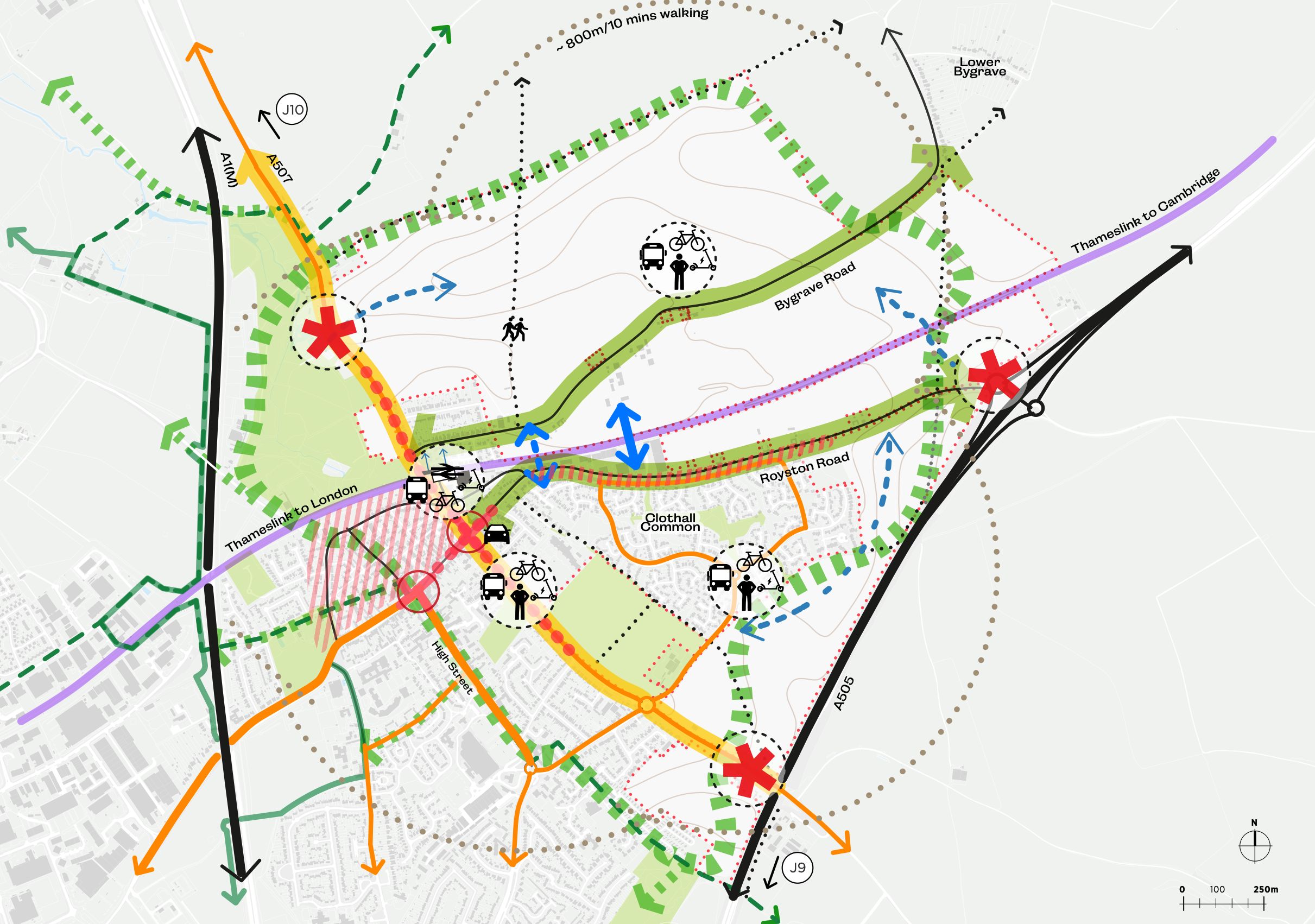
We know from the Neighbourhood Plan, that traffic volumes are a concern and that the Whitehorse Street junction is a focus for congestion in the town. Baldock rail station is a great asset that we hope to improve. While there is an existing bus service, enhancements are likely needed to better connect new and existing communities.
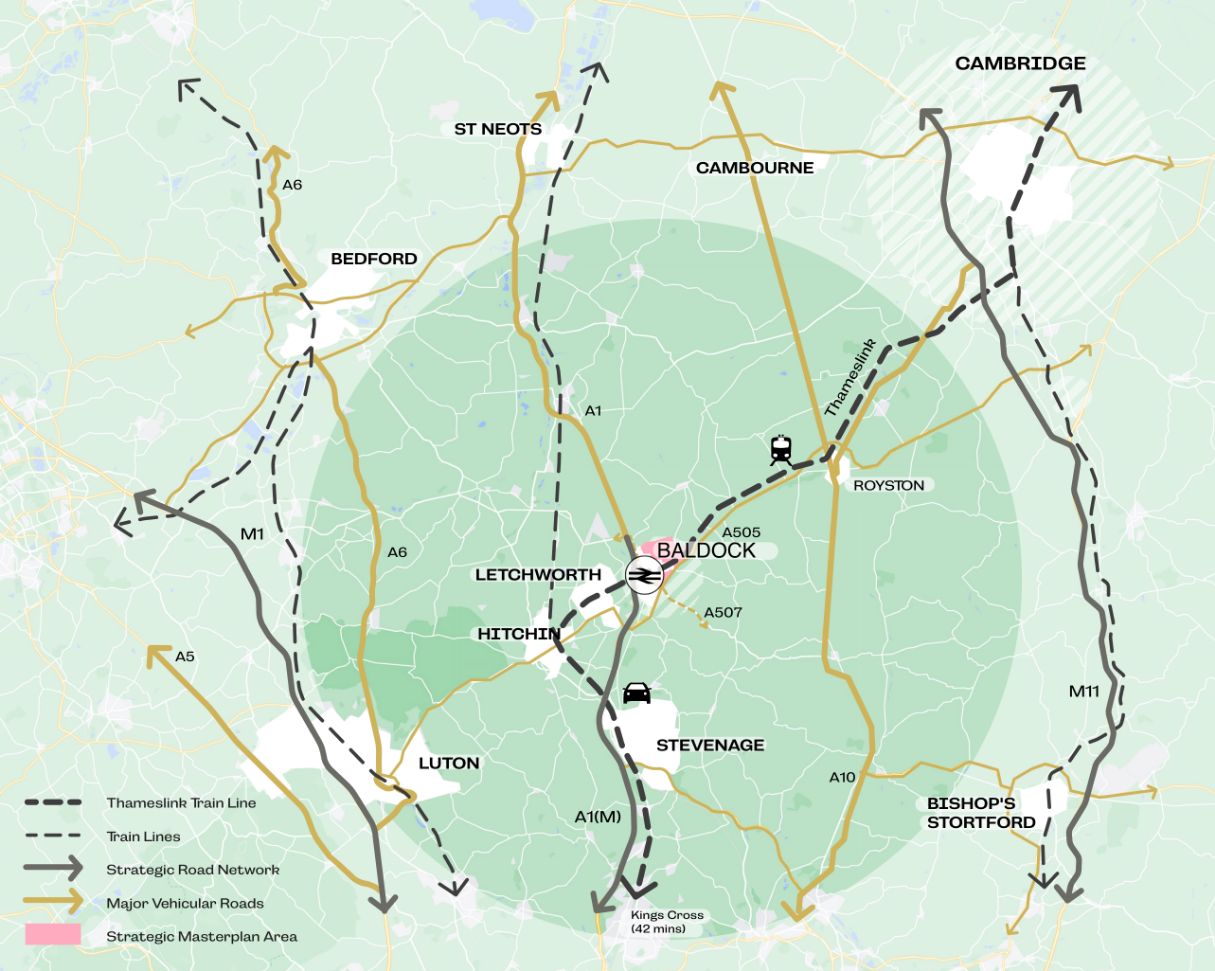
- The site is located close to the Strategic Road Network, with the north-south A1 running broadly to the west of Baldock connecting St Neots and Stevenage, the north-south A507 to the west of the site and the east-west A505 on the east of Baldock, connecting Royston and Letchworth/Hitchin;
- The existing road network is congested, particularly at peak periods with the network providing important links across the county, and with many longer-distance journeys being made through the town.
- There is limited provision for cycling in the town, with no cycle tracks and limited parking.
- There are a network of Public Rights of Way around Baldock and through the site, offering excellent opportunities for connections to the countryside; Conditions for walking are generally good in the centre of the town but footways can be narrow and crossings limited, particularly on the edge of the town.
- Baldock railway station is located to the south west of the site which provides services to Cambridge and London Kings Cross, Gatwick Airport and Brighton. Access to the station is currently constrained and the railway line acts as a barrier to north-south movement.
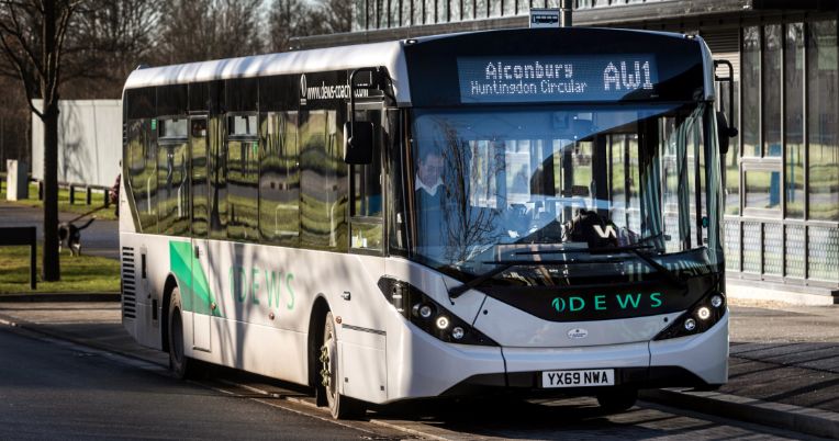
- Baldock is served by multiple bus services, but they often offer a low frequency of services at peak times.
- Hot spots of congestion are present in the town centre, particularly at the Whitehorse Street / Clothall Road junction.
- Bygrave Road runs through the centre of the site, which also includes a network of public rights of way and bridleways.

What the data tells us
A wide range of data has already been collected to understand existing movement patterns around the site, within Baldock and the wider area.
This data shows that a significant proportion of trips are relatively local but that around half of the road traffic is through-traffic and does not stop in Baldock. Instead it is using the town centre route as a cut through to connect to strategic routes around the town.
- The Local Plan identifies the need for a ‘link road’ through the site to connect North Road and Clothall Road and help ease congestion within the town centre. However, putting a link road in which takes longer to use, would not significantly reduce the traffic through the town. It is important that any proposals for new roads also consider how the existing roads are modified to reduce the amount of through traffic.
Opportunities and ideas
- Provision of jobs, schools, shops and community facilities next to new homes will encourage active travel (walking/cycling) to daily destinations.
- Delivering a new ‘Green Loop’ around the north, east and southern edges of town which could connect in with the existing cycle and walking loops for Letchworth Greenway and Etonbury Wheel, creating a great leisure route for people to enjoy.
- Opportunities for footpaths, bridleways and cycle paths within the site, integrated into the development and open space and importantly, making strong connections to the town centre and wider countryside beyond.
- Improvements to the railway station and access to it, as well as providing a pedestrian crossing of the railway line, to improve north-south connectivity.
- More buses in peak times and exploring, demand responsive and flexible services to meet people’s needs.
- Potential for improvements to routes from the site to the town centre to enhance access by pedestrians and cyclists.
- Opportunity to transform Bygrave Road into a route which prioritises walking and cycling.
- Opportunity to create new ‘gateways’ into the town, which might be measures to reduce vehicle speeds within the town.
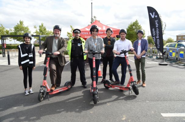
- Potential for new ‘transport hubs’ in the new community and near the train station which bring together transport options: such as bike and scooter hire/parking, car club/hire with bus services.
- Potential to reduce levels of through traffic in the town by encouraging it to stay on the Strategic Road Network (e.g. A1, A505).