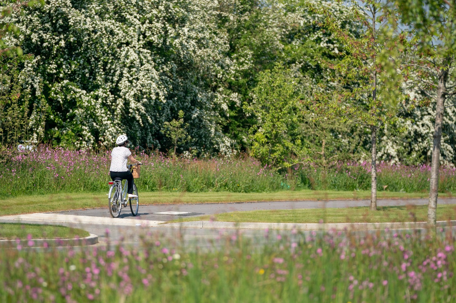
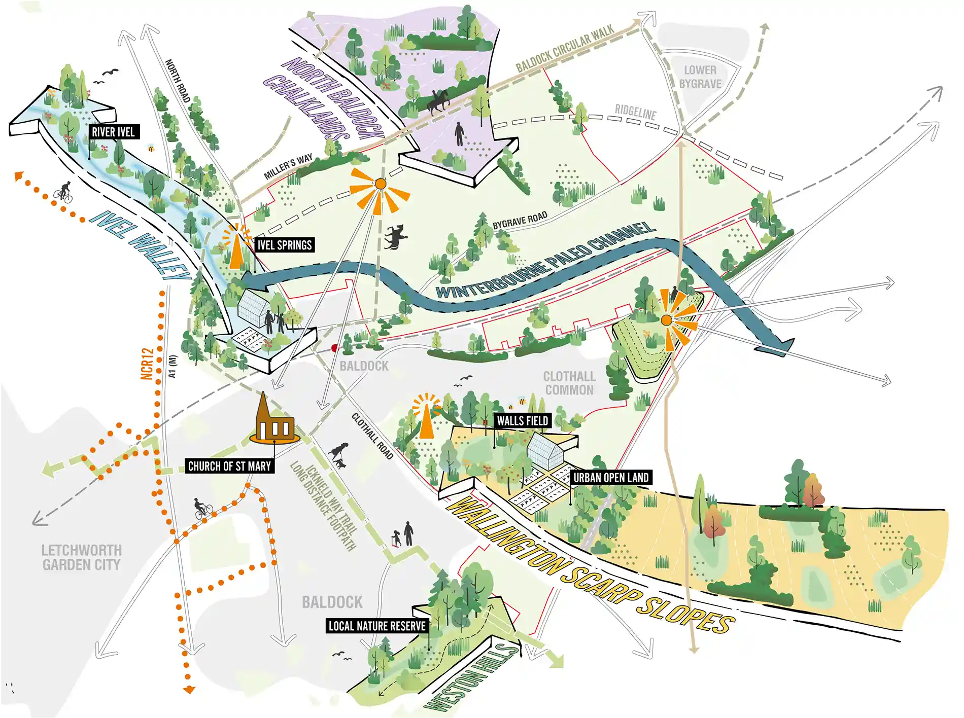
A Greenway for Baldock
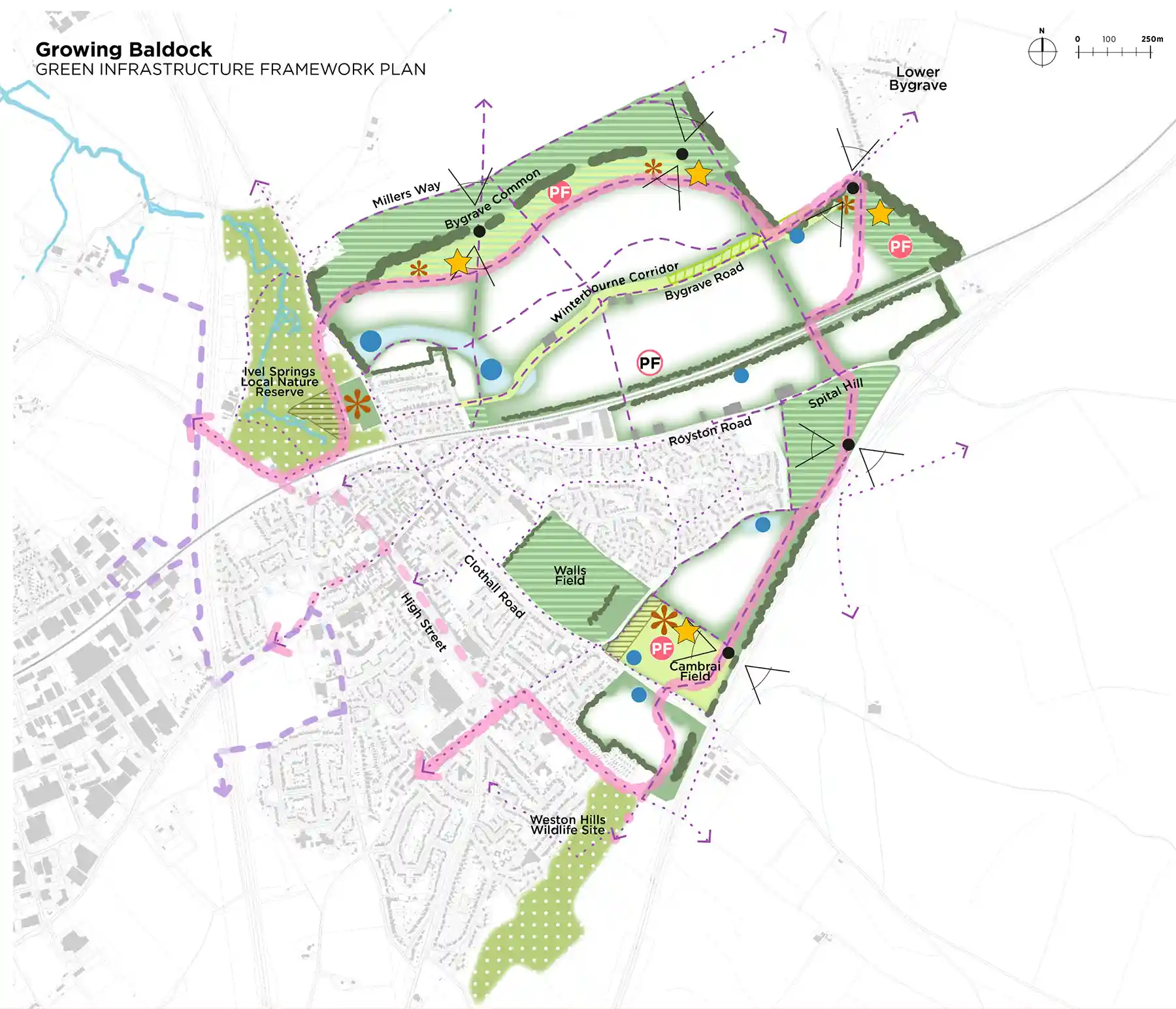
Green infrastructure framework

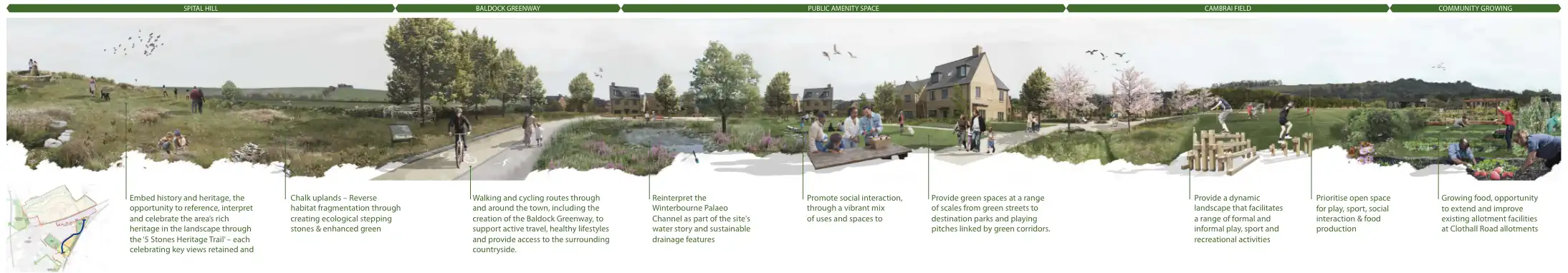
Key Principles
Inherited assets – working with the area’s landscape, history and habitats.
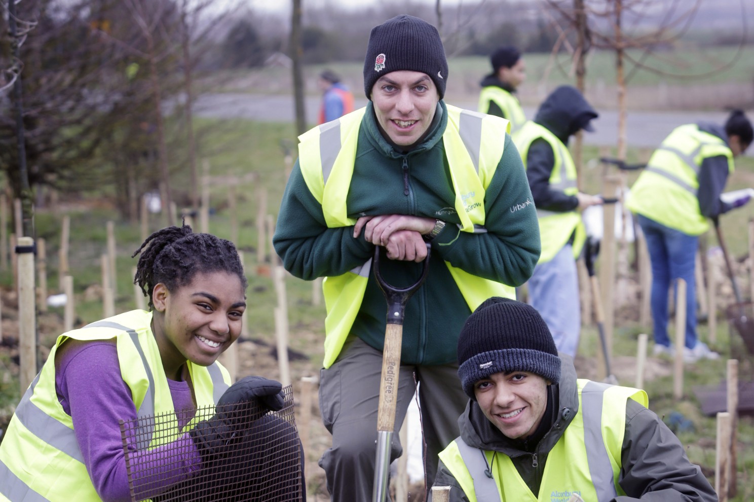
Prioritising nature rich places – creating and linking a range of habitats and safeguarding the Local Nature Reserves.
Celebrating heritage – embracing the area’s rich archaeological heritage by creating a ‘heritage trail’, reinterpreting the historic ‘winterbourne’ and creating a new ‘Bygrave Common’.
Getting around – dedicated walking, cycling and horse riding routes through the development and beyond, as part of the new Baldock Greenway.
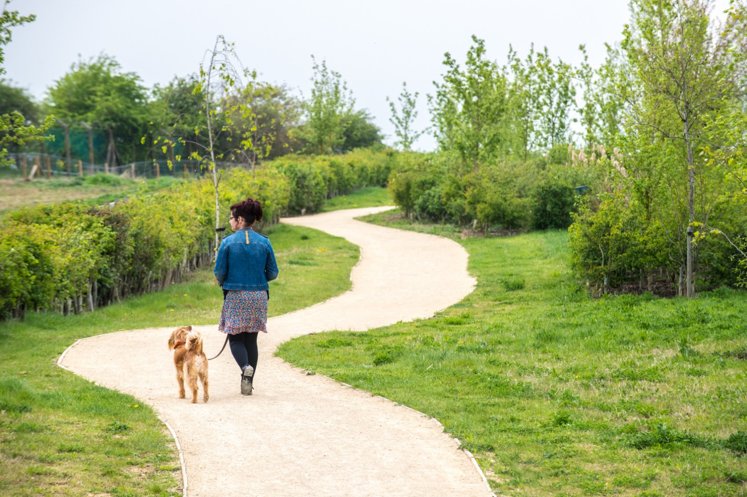
Parkland Destinations – new community green spaces for people to play, exercise, meet, socialise, relax, grow and connect with nature.
Landscape Character – creating new landscapes influenced by the surrounding Ivel Valley, chalk uplands, Wallington scarp slopes and Weston Hills.
You told us …
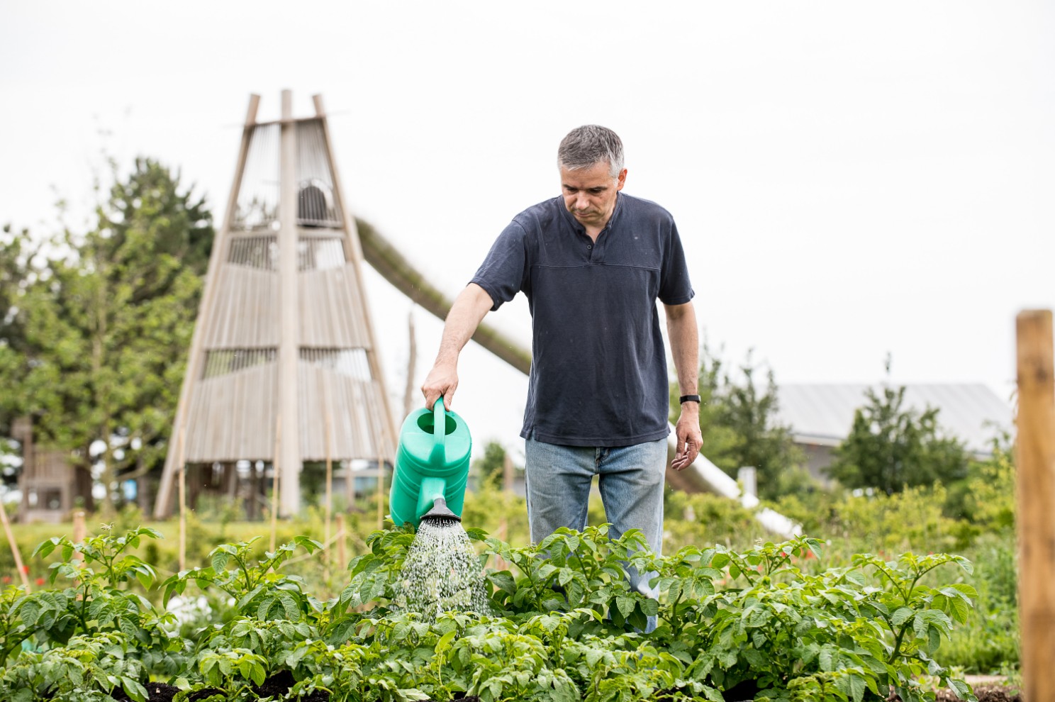
…space needed for wildlife
Baldock's green features should be protected.
…green buffers between existing homes and new development.
Protecting the Ivel Springs chalk stream is important.
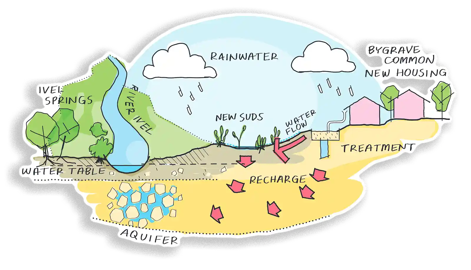
Water to the River Ivel
Recharging the River Ivel
The development will contribute as far as possible to helping resolve the issues facing the River Ivel chalk stream. During the initial phases of development, sustainable drainage features will capture and convey surface water and allow it to infiltrate into the ground. This will help recharge the existing aquifer which feeds the River Ivel and provide ecological benefits to the wider area.
Water levels in the aquifer will be monitored and if the infiltration has helped to recharge it sufficiently, later phases of the development may begin to re-use surface water within the new homes and buildings instead, through water ‘harvesting’ methods. This would reduce the overall demand for water generated by the new development.
Sustainable drainage features will be located in the lowest parts of the site and in green corridors to create wetlands that prevent or alleviate flooding. Sustainable Drainage Systems are an environmentally beneficial way of managing rainfall where it falls, by capturing, transporting and slowing down run off before it enters local streams and rivers. They are an efficient and sustainable way of draining surface water that also minimises pollution and reduces impacts on local water quality.
Water treatment
The first 200 homes can drain to the existing foul water drainage system via the Baldock–Norton Road pumping station. After this, a new sewer connection will be put in place to Letchworth Wastewater Treatment Plant.
Water supply
We are speaking with Affinity Water, the water authority who will supply water to the development. Their strategic plans for water supply will factor in the growth of Baldock and the increased need for water to serve the new homes and businesses. We will continue discussions with Affinity Water as the development progresses to planning application stage.
Bringing the past to life
Baldock has a very rich history, with evidence of human settlement since prehistoric times. It is likely that parts of the site contain valuable archaeological remains which will help to tell the story of the town. Extensive archaeological investigations have already taken place and more are ongoing, in the areas of most interest.
The masterplan will incorporate many of these areas into green spaces, connecting them via a new ‘heritage trail’ that celebrates Baldock’s long and fascinating history. The trail will provide viewpoints, landmarks and interpretation boards to explain the importance and heritage of the town.
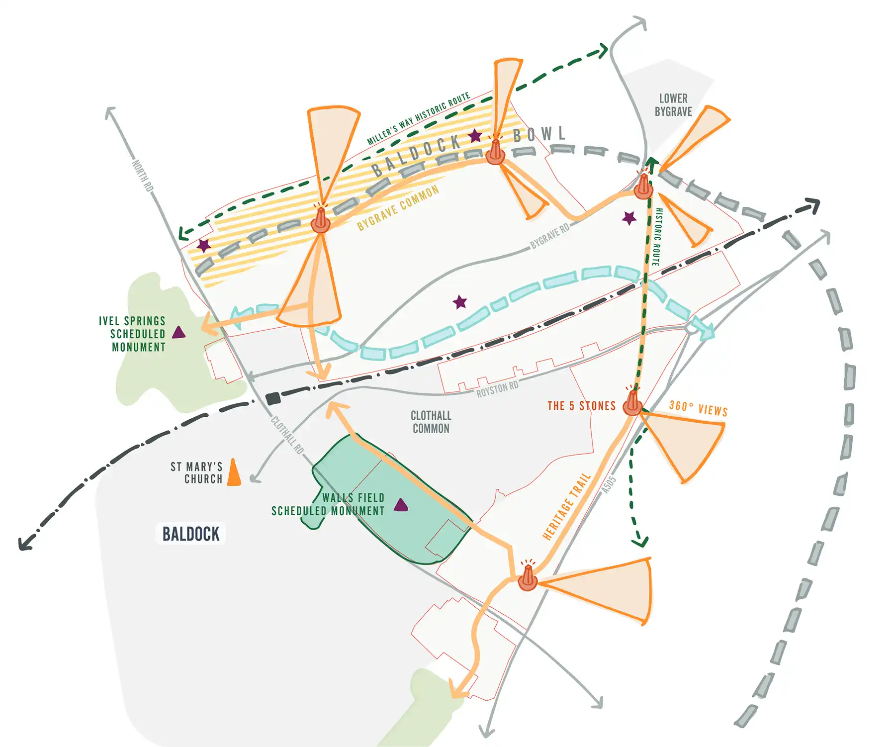
Celebrating Baldock's heritage
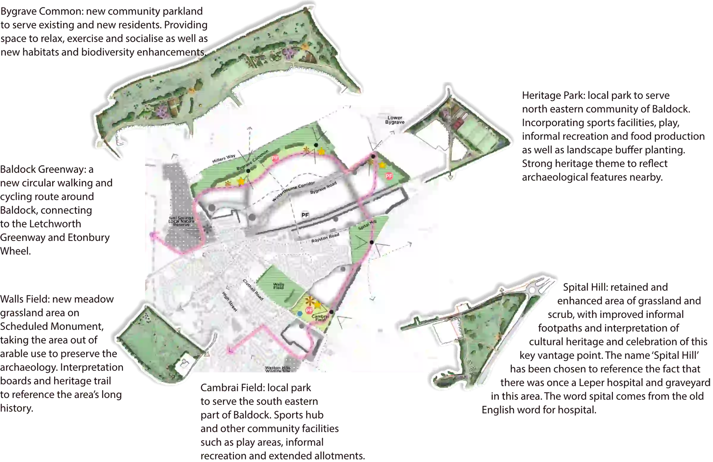
A new Bygrave Common
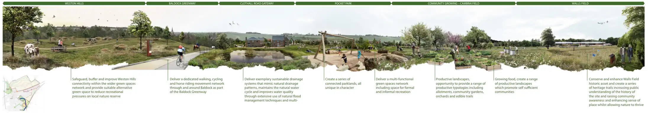
A series of different green spaces will frame the development and have different functions:
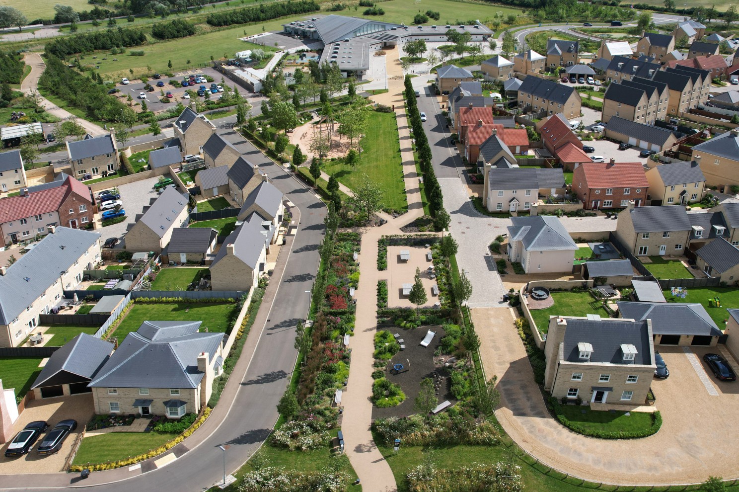
How it could look and feel
Ivel Springs to local centre
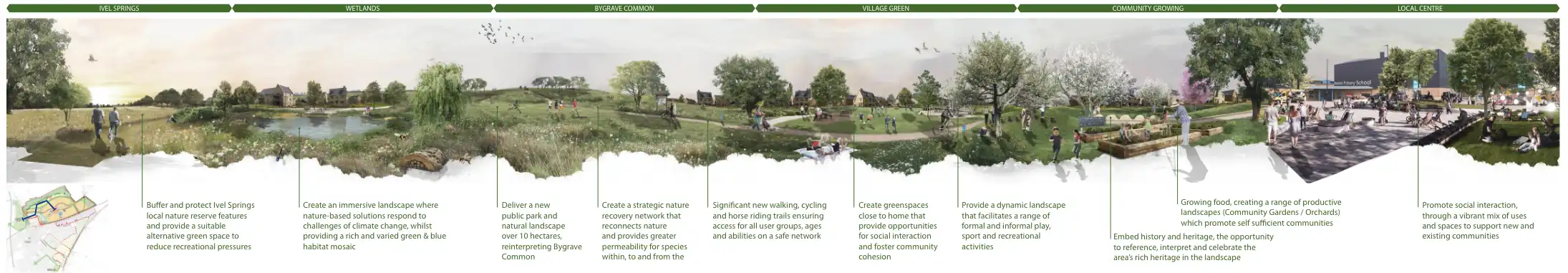
Spital Hill to Cambrai Field
Weston Hills to Walls Field