Green infrastructure, ecology and heritage
We know the importance of both green space and nature, and of the important heritage that lies within and below Baldock.
We have considered these together, to explore how the development of Baldock can bring more green space to the heart of the town, as well as provide corridors for nature and people out to the countryside beyond. And to ensure what comes forward reflects and continues to connect people to the history of the town.
What we know
Green Infrastructure / Landscape
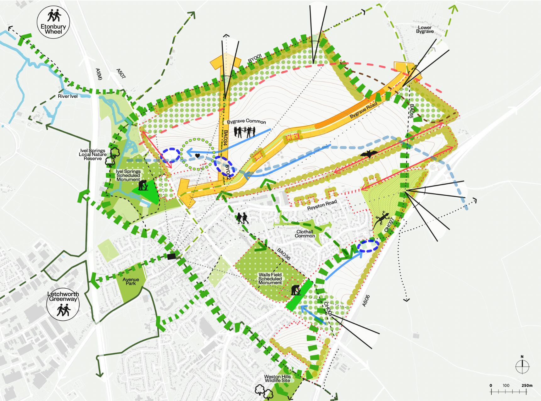
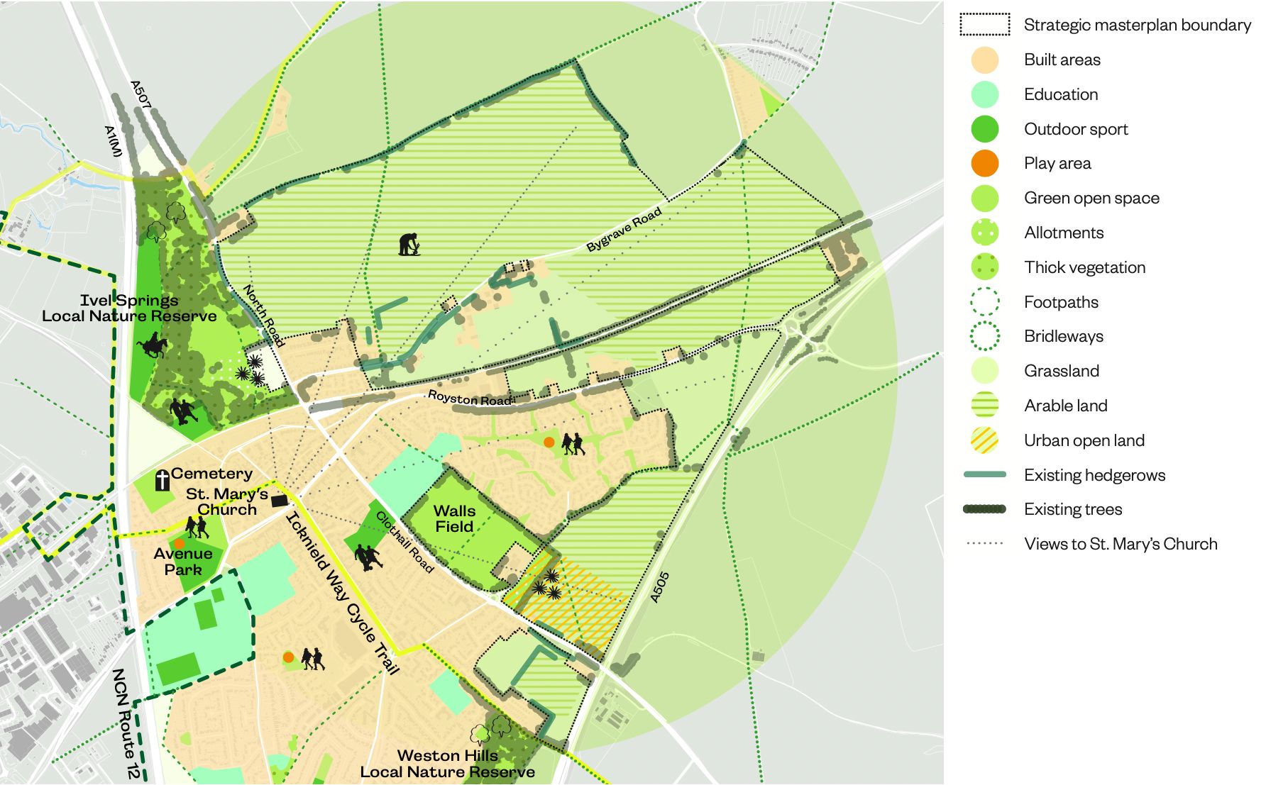
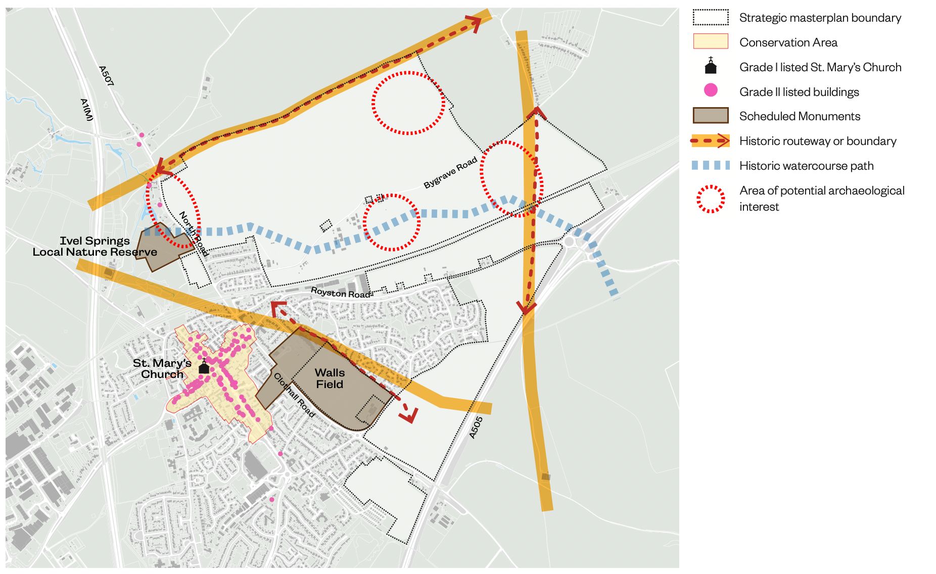
- Baldock lies in a bowl largely hidden from many surrounding locations. Views of the site and beyond to St Mary’s Church in the centre of Baldock are possible from the network of public rights of way within and around the site.
- The site is currently predominantly used for arable agriculture, with small areas of woodland, grassland and hedgerows with limited public access.
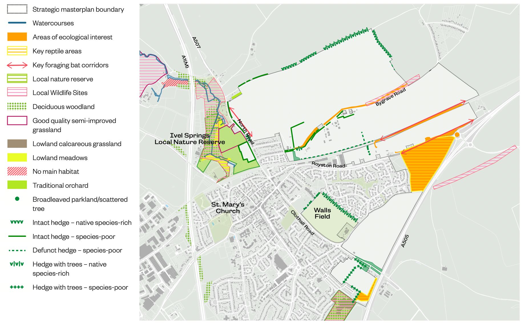
- Ivel Springs and Weston Hills Local Nature Reserves (LNR) are located to the west and south of the site. Action Plans for both LNRs identify opportunities for enhancements.
- Other existing open space in the vicinity of the site includes the Great North Road allotments and Clothall Road allotments, Walls Field and the area north of Clothall Road designated as Urban Open Land in the Neighbourhood Plan: meaning they should be retained and enhanced to provide green space for the town to enjoy.
- The North Hertfordshire Open Space Settlement Profile: Baldock (2022) identifies that Baldock has a deficit of parks and gardens, outdoor play space for children and teenagers and amenity green space.
Ecology
- A Preliminary Ecological Assessment has been undertaken of the site and detailed ecological surveys are underway over the next few months.
- The site is made up of a range of habitats of varying quality and ecological value, including amenity grassland, dense scrub, hedgerows and trees, improved and semi-improved grassland and woodland.
- A number of protected and notable bird species such as Corn Bunting are known to be present on the site and there is some good habitat for bats particularly towards the edges of the site, connecting to adjacent off-site habitats.
- A triangular part of the site, south of Royston Road, which is the spoil from the building of the bypass, has become a good environment for reptiles.
- A small, linear Local Wildlife Site runs along Bygrave Road and as with the two Local Nature Reserves at Ivel Springs and Weston Hills, consideration will need to be given to ensure new green space works with them, and provides recreational space to avoid too much footfall on the more sensitive areas of the reserves.
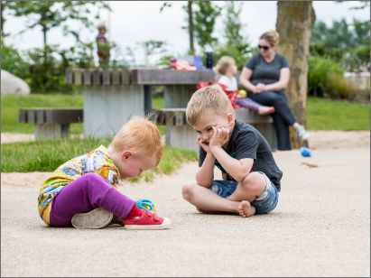
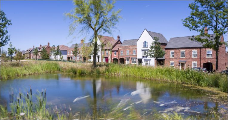
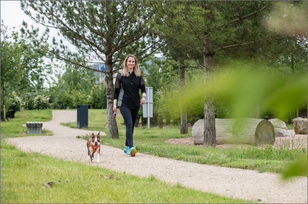
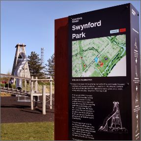
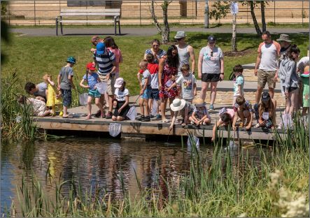
Images demonstrating approach at similar Urban&Civic developments
Heritage and Archaeology
- The site, and wider area, contains a large number of historic records and is considered important in terms of its potential for pre-historic to Roman archaeological remains.
- Historic routeways and local springs are thought to have shaped the settlement pattern of the area.
- Baldock Conservation Area is located to the southwest of the site in the historic core of Baldock, containing the majority of listed buildings in the town.
- Four listed buildings beyond the town centre are located on North Road.
- Two Scheduled Monuments are close by marking a historic farmland settlement at Ivel Springs and the historic core of Baldock at Walls Field.
- Grade 1 Listed St Mary’s Church in the town centre is the most visually striking building in Baldock, with views of the spire from all around.
- The site has been the subject of many archaeological investigations over the years.
Opportunities and ideas
Green and blue spaces will be a fundamental part of the development: both ensuring generous open space for the new residents moving in, and connecting and enhancing other local green spaces for the wider area.
- Creation of new northern boundary park for Baldock, ensuring green separation from Bygrave with strategic scale green space.
- Integration and interpretation of archaeology and heritage into green space.
- Potential to reinstate the historic winterbourne as part of a new corridor of sustainable drainage and green space.
- Dedicated and connected ecological areas to provide vital habitats for priority species, with nature corridors linking to existing nature reserves.
- Provision of different types of green space on site to provide recreation for people and relieve pressure on nature reserves.
- Creation of landscape buffer corridors along main roads and railway lines.
- Preservation of long-distance views to the countryside and to St Mary’s church.
- Retention of the open character of Walls Field and the Urban Open Land.
- Exploring the opportunity to recharge groundwater through sustainable drainage systems.
- Improved connections to Ivel Springs and Weston Hills Local Nature Reserves, as part of wider ‘Green Loop’ around Baldock.