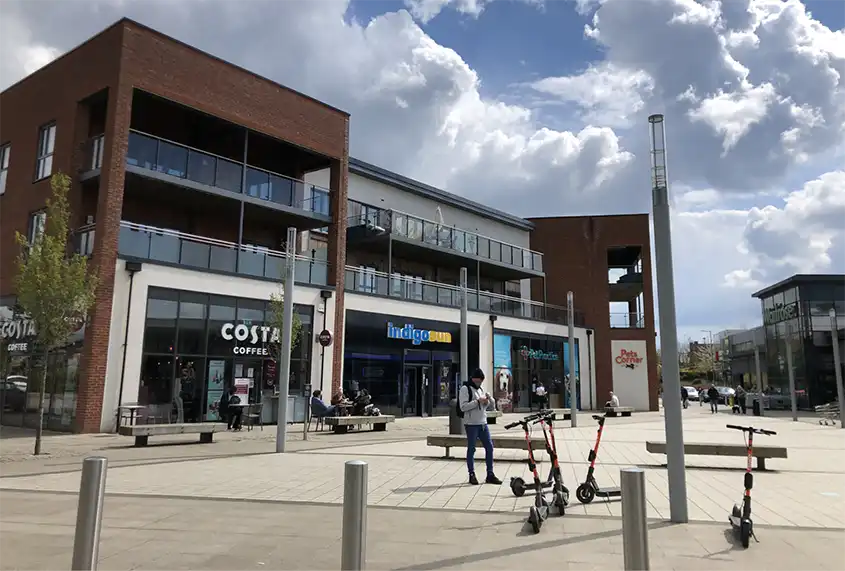
Helping you get about
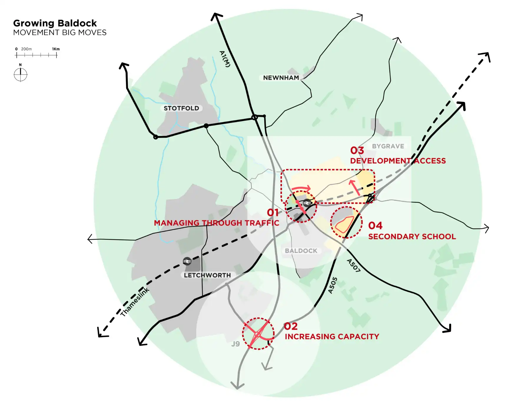
Baldock 'Big Moves'
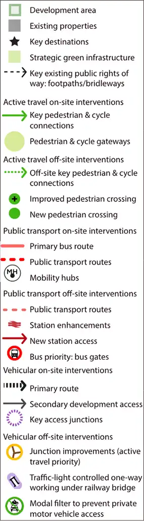
Key principles
There will not be one stand out intervention, rather we are suggesting a range of changes that influence the way people move about and through Baldock.
The development will be designed around three sustainable travel principles:
- Designing a place where half of all trips are made on foot, bicycle or by using public transport, drawing on best practice across the UK and Europe;
- Delivering improvements within the town that encourages walking, cycling and public transport within Baldock, creating one connected town;
- Restricting through traffic and making it more difficult to drive through the town, including less room for cars underneath the existing railway bridge.
These principles have fed into the following transport objectives
for the scheme:
- Reducing car dominance in Baldock;
- Safe, direct and coherent networks for active travel (i.e. walking and cycling);
- Green routes, helping people move away from roads;
- Prioritising buses over private vehicles;
- Excellent rail access;
- Managing freight and logistics;
- Reducing reliance on the private car.
Why are we taking this approach?
Our research suggests that where conditions are improved for walking, cycling and public transport, more people choose to travel in this way. We will create walking and cycling networks that are suitable for people of all ages, confidence and abilities.
We know there is traffic congestion within Baldock at peak times, worsened by through traffic that doesn’t stop in the town. We have developed a package of measures that encourages through traffic to stay out of the town centre. This creates the opportunity to provide more road space for walking, cycling and greater priority for buses.
Additional capacity may be needed at Junction 9 of the A1(M), to accommodate traffic no longer passing through Baldock.
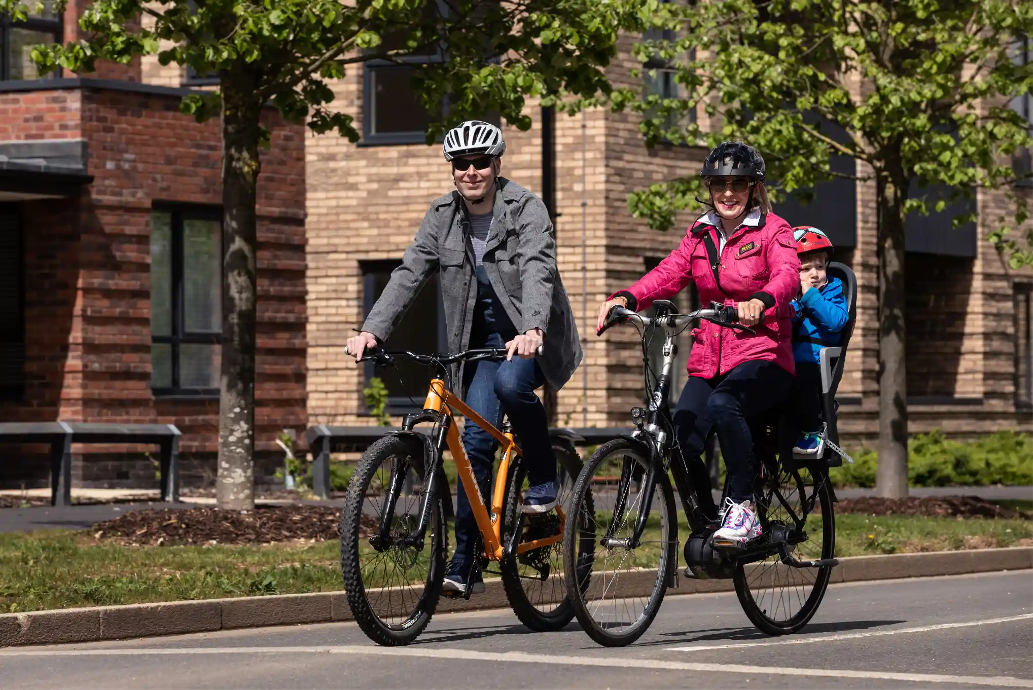
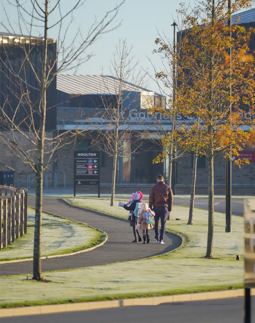
Walking and cycling
- Safe, continuous and attractive walking and cycling routes to key local destinations such as the local centre and schools, the employment area, informal play and meeting spaces;
- Traffic-free routes will be well lit and busy spaces, overlooked by buildings;
- Streets that prioritise walking and cycling, including traffic free cycle routes in busier locations;
- A dedicated walking and cycling bridge over the railway, connecting development either side of the tracks and Clothall Common;
- New paths and improvements to existing routes
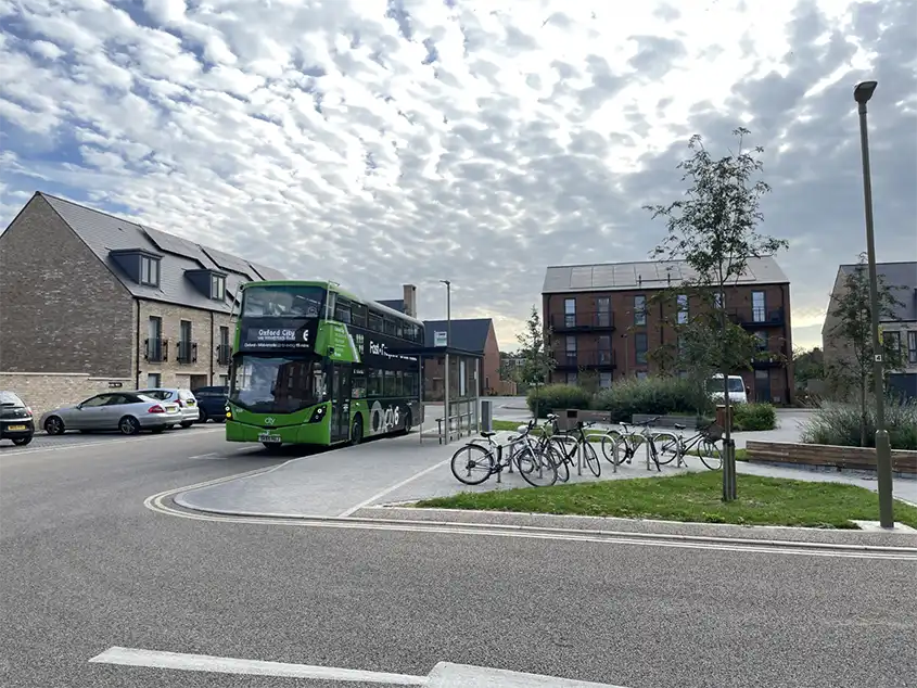
Public transport
- Bus services to Baldock town centre and Letchworth including some traffic-free bus ways, for example, into Clothall Common;
- Bus stops within 400m of most homes;
- A network of ‘mobility hubs’ where people can easily switch from one mode of transport to another, to make travelling without a private car easier;
- A new northern access to the rail station, and improvements to the quality of the station building.
Motor vehicles
- Access into the development via a new road connecting North Road and Royston Road;
- Car club cars will reduce the need to own a car;
- Car parking will not block pavements and parking areas will be designed flexibly, so they can be used differently in the future, if demand reduces over time;
- Deliveries will be managed via ‘consolidation points’ and ‘pick-up lockers’, so that the number of delivery vans and lorries on residential streets is minimised. Dedicated loading bays will be provided to prevent pavements from being blocked.
Here's what we propose:
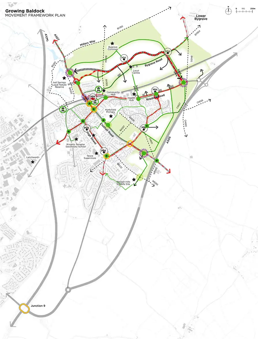
Walking and cycling conditions within Baldock, between key destinations, will be safer and made suitable for all ages and abilities, through a combination of widened pavements, traffic-free cycle paths and reduced traffic on quieter back streets. Improved junctions and crossings are proposed at key points in the town to enhance the pedestrian and cyclist experience. The main changes are set out below:
- Simplification of the Whitehorse Street junction to provide wider pavements, direct pedestrian crossings and safer traffic movements, including the potential to prevent some turns, (for instance, not allowing people to turn left into Station Road if coming from the High Street), to encourage use of the new road and through traffic to stay on the major roads surrounding the town;
- Redesign of the Station Road / Icknield Way junction to provide improved access to the station for pedestrians and cyclists, and to create a new eastwest cycle route connecting the town with the proposed employment area on Royston Road;
- Redesign of the Station Road / Icknield Way junction to provide improved access to the station for pedestrians and cyclists, and to create a new eastwest cycle route connecting the town with the proposed employment area on Royston Road;
- A new access is proposed into Clothall Common from Royston Road. This would allow access by buses, cyclists and pedestrians, but not private vehicles;
- Provision of additional capacity on the major roads surrounding the site, focused on Junction 9 of the A1(M). We know congestion at this junction causes many people to travel through the town and if traffic moved more quickly through it, fewer would choose to do so;
In order to allow the improvements above to be delivered, modal filters (which allow pedestrians and cycles to pass only) are proposed on Norton Road, Bygrave Road, Icknield Way and Football Close. Traffic light controlled one-way working is proposed on Station Road under the railway, along with restricting the left turn into Station Road from Whitehorse Street. Taken together these measures will reduce through-traffic volumes, providing space for high-quality walking and cycling routes and improved bus journey times. While bringing some benefits, this may inconvenience some people who would need to access Baldock in a different way.
We counted the number of vehicles on the roads in Baldock and we think that a new high-speed link road would not remove significant volumes of traffic from the town centre and would be likely to draw more traffic off the major roads, increasing overall traffic volumes. Instead, a new slow speed access road into the development will be fronted by buildings, pavements and a separate cycle path, and will connect the A507 to the A505. This combined with preventing some turns at the Whitehorse Street junction, will take some traffic out of the town centre without increasing overall traffic volumes.
How will we know these measures are working?
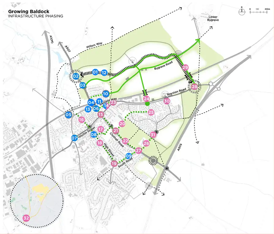
- The development sites will take many years to build and therefore we propose working with the councils and residents to monitor the impact of our proposed measures over time. This will ensure there is flexibility to change proposals, including reallocating funding, as required;
- Our initial thoughts on when the changes which will affect how people move around Baldock will happen are shown below. The measures, and their timing, are being discussed in detail with Hertfordshire County Council (highways team).
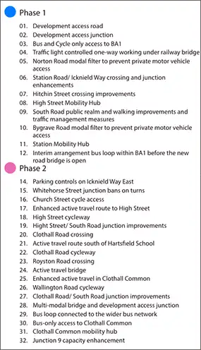
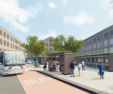
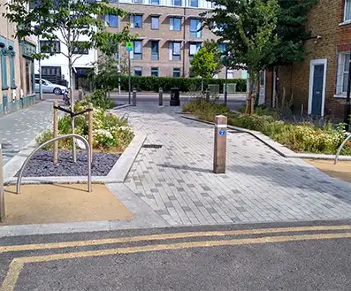
Mobility hubs
- Mobility Hubs bring together a range of transport options in one place, to make travelling without a private car easier;
- A network of mobility hubs will be provided, incorporating a range of options such as bus stops, cycle and scooter hire, cycle parking, car club spaces, cycle repair, shopping pick up / drop off lockers, EV charging points.
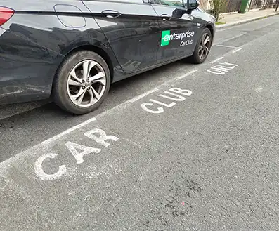
Car club
- Car club cars can be booked by the hour and all costs are covered;
- Provides comfort that a car will be available if needed, reducing the need to own private cars;
- Car club vehicles are generally newer and less polluting than the average car.
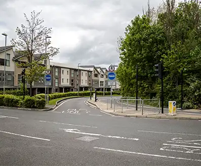
Bus gate
- A bus gate is a section of road along which only buses and other authorised vehicles (such as emergency vehicles) can travel;
- A bus gate is proposed at the entrance to the development on North Road, providing a bus only link into the new community;
- Another is proposed from Royston Road south into Clothall Common.
Shuttle working
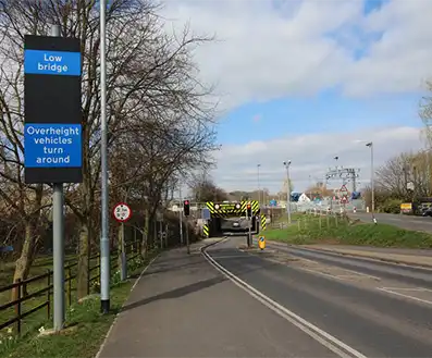
- The limited space under the Station Road railway bridge means the existing pavements are narrow and there is no space for a dedicated cycle route;
- Narrowing the carriageway under the rail bridge for general traffic to one lane would provide space for pedestrians and cyclists;
- The single lane of traffic would be controlled by traffic lights.
Modal filter to prevent private car access
- Modal filters can be used to prevent rat-running, for instance by vehicles using Norton Road to go into Baldock;
- Modal filters allow pedestrians, cyclists and buses to move along a street while restricting general traffic, with benefits to air quality, safety and quality of life along residential streets.