Questions you may have
What happens now the Application has been submitted?
- Formal consultation - The Council will run its own formal consultation. This will be your opportunity to comment on the submitted plans directly.
- Council review - The plans and all consultation feedback will be reviewed by North Herts Council, alongside input from a range of stakeholders.
- Legal Framework - During the review stage, an initial framework will be developed to outline the delivery timing and funding of key amenities — including schools, the health centre, green spaces and more — to ensure they are delivered alongside new homes.
- Planning Committee decision - Following review, the NHC Planning Committee will consider the
application and decide on the next steps.
How do I comment on the planning application?
You can view and comment on the planning application on NHCs website: https://www.north-herts.gov.uk/view-and-comment-planning-applications
If you have any questions or need assistance finding information within the documents, just get in touch: growingbaldock@urbanandcivic.com
What are you asking outline planning permission for?
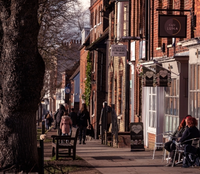
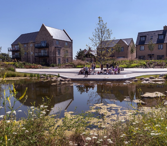
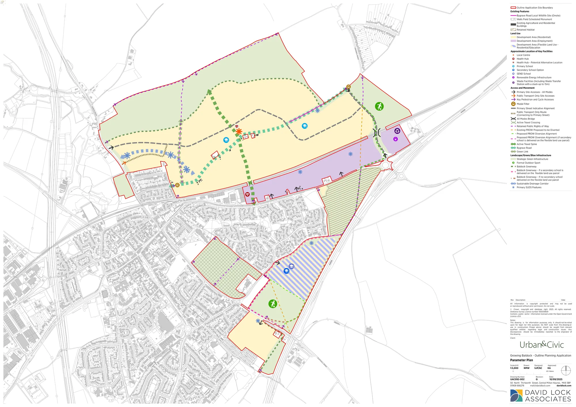
The Outline Planning Application seeks permission for up to 3,200 new homes, including homes to buy, rent and affordable homes, together with supporting infrastructure including schools, health, a local centre, sports and play, and green space, as shown in the Parameter Plan below.
The Outline Planning Application also includes detailed designs for the main site access points into the site, on North Road (vehicular and bus only), Clothall Road and from the A505/Royston Road roundabout.
Parameter Plan
When would building start if the Outline Planning Application is approved?
If approved by NHC, the Outline Planning Application would establish the overall framework for development.
Further detailed applications would then need to be developed and approved by NHC for specific areas - individual housing parcels or buildings, green spaces and schools, with consultation at each stage.
We plan to start development in BA2, followed by BA1 (broadly delivered from west to east) and BA10, potentially in parallel with BA1.
The phasing and land use mix of BA3 will depend on the outcome of the discussions on secondary school provision and you can find out more on this below.
The phased construction will take around 15 years and we will continue to consult with the community on the more detailed plans.
What is the approach to providing schools?
Pupils from the new homes will initially fill places at existing primary schools. To accommodate long-term growth, up to two new primary schools are planned north of the railway.
Land is also being made available for a special educational needs and disabilities (SEND) school.
For secondary education, a flexible approach will be taken in partnership with local stakeholders, with a shared aspiration to deliver a larger, relocated Knights Templar School (KTS) within the new development.
As funding is not yet secured for this preferred option, the planning application will include three potential scenarios to ensure resilience:
- Relocate and expand KTS to a new site within the development (preferred option)
- Expand KTS on its existing site.
- Open a smaller new secondary school in the proposed location to work alongside KTS.
These options will continue to be explored in collaboration with Urban&Civic, the District and County Councils and the Department for Education over the coming years.
You can find out further information on this topic in the following Outline Planning Application documents:
| Parameter Plan | Shows the location of schools |
|---|---|
| Design and Access Statement | Placemaking and the integration of new facilities |
What is the transport strategy?
We have developed a three-point transport plan, developed over a number of years through consultation and detailed analysis:
- Reduce through-traffic that doesn’t benefit Baldock, especially lorries, to ease congestion, improve air quality and make roads safer. New connections to the existing town centre will also encourage sustainable movement by walking and cycle routes. This includes:
- Building a new road across the railway line to link north Baldock with Royston Road and the A505.
- Introducing a one-way alternating traffic system under the Station Road railway bridge.
- Create a Create a ‘Walk and Cycle First’ town — making it safer and quicker to walk or cycle to key locations including new pedestrian and cycle crossings over and under the railway. We are aiming for half of all trips by new residents to be made on foot, by bike, or via public transport.
- Improve connections between Baldock and nearby villages through new road, cycle and bus links. This includes:
- A new road link to provide better access to the town centre, retaining Bygrave Road as a pleasant walking and cycling route.
- Improved access to the station via a new northern entrance with walking, cycling and bus connections.
- Integrated bus services, including coordination with existing routes and a new shuttle bus loop through the town.
You can read more about the transport proposals here
You can find out further information on this topic in the following Outline Planning Application documents:
| Parameter Plan | Key access points and routes through the site |
|---|---|
| Environmental Statement (transport) | Transport impacts and mitigation |
| Design and Access Statement | Street and walking/ cycling route types and car parking principles |
| Transport Statement | Approach to transport on site and wider impacts and mitigation |
| Travel Assessment | Measure to encourage active and sustainable modes of transport |
How has the transport strategy been tested?
The approach to developing a strategy and modelling the proposals to understand their impact has been agreed with Hertfordshire County Council (as the highways authority) and North Herts Council (as the planning authority). It has involved surveys of the existing road network, and then modelling each of the interventions through a model created with the transport consultant and agreed with the County Council.
The findings will also be tested by the County Council’s own strategic model (COMET), which will be made available over the next few months. This will enable us to check the findings of the model, and if additional adjustments need to be made or information provided, this can be done while the application is being considered.
We know transport is a topic of interest locally and the findings from the COMET model and the updated Transport Assessment will also be made public on NHC’s planning website.
When will key facilities be delivered?
You can find out further information on this topic in the following Outline Planning Application documents:
| Parameter Plan | Shows the location of schools, heath centre, local centre and green spaces |
|---|---|
| Design and Access Statement | Placemaking and the integration of new facilities |
What parts of the new development will remain green?
You can find out further information on this topic in the following Outline Planning Application documents:
| Parameter Plan | Areas of retained and new habitat |
|---|---|
| Biodiversity Net Gain Plan | Areas of biodiversity net gain |
| Environmental Statement (ecology) | Ecological impacts and mitigation |
| Environmental Statement (Landscape and Visual Impact Assessment) | Effects of development on landscape and views |
| Ecological Management Plan | How ecological areas will be managed |
| Green Infrastructure Strategy | Locations and types of green space |
What are the impacts on local water and the local aquifer, an important source of fresh water?
The local water company - Affinity Water - have confirmed there is enough water to support the new development and there will be no groundwater extraction from the aquifer to cater for new homes.
Detailed design of the homes will include a range of low water technology.
The landscape is also designed to capture surface water run off to maximise infiltration into the aquifer.
You can find out further information on this topic in the following Outline Planning Application documents:
| Sustainability Statement | The approach to delivering sustainable development |
|---|---|
| Drainage Strategy | How the drainage is designed |
Will there be a new health facility?
You can find out further information on this topic in the following Outline Planning Application documents:
| Design and Access Statement | Placemaking and integration of new facilities |
|---|