Green space and nature

In addition to protecting Ivel Springs and Weston Hills Local Nature Reserves, key green spaces will be enhanced and new ones delivered.
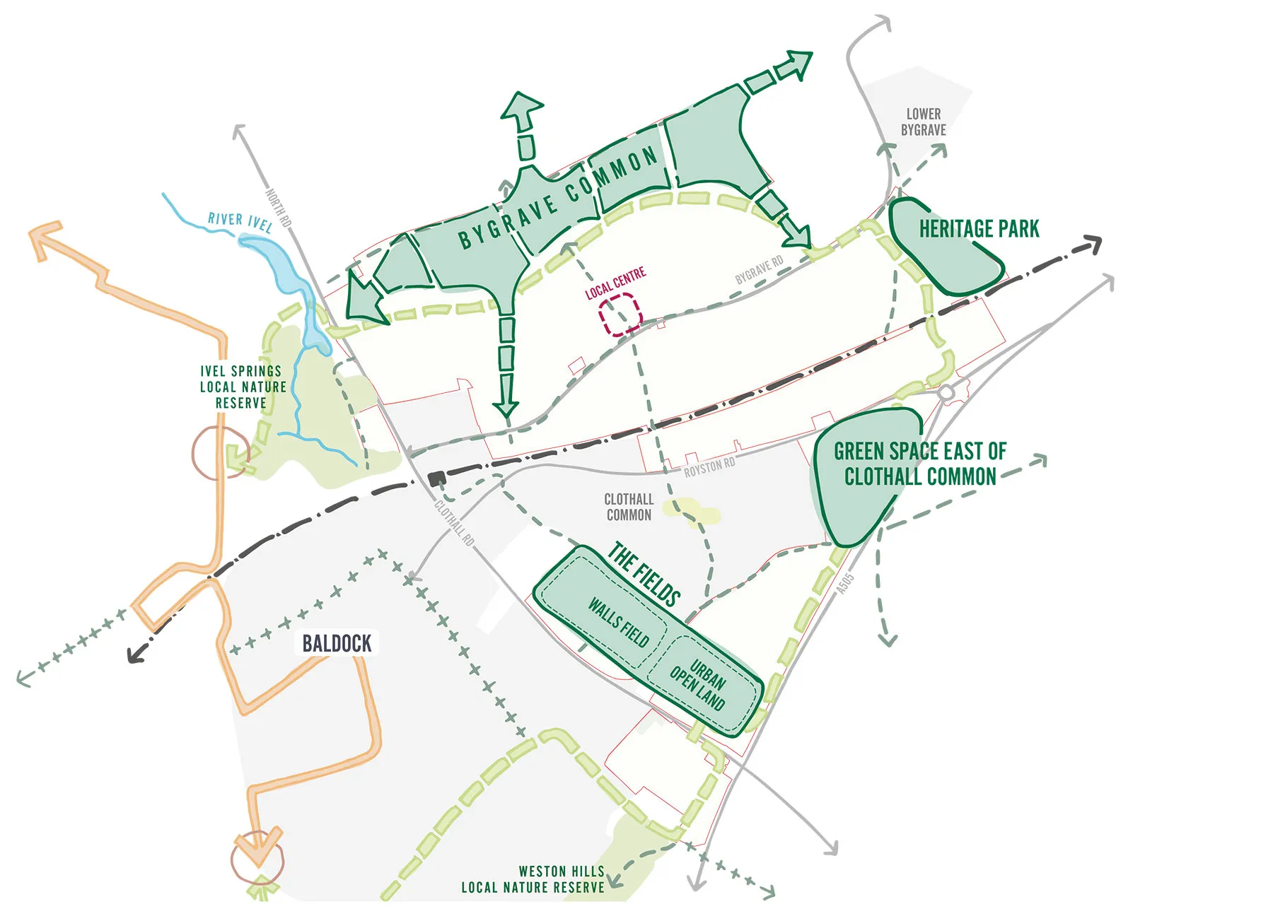
5 key destinations diagram

Baldock Greenway and connecting green corridors

A new circular leisure route will form a continuous loop around the town, linking all green spaces with safe and accessible paths for walking, cycling and horse riding. This Greenway will also connect with existing routes to create an extensive network of green corridors that support movement for both people and wildlife. It will also feature a Heritage Trail with viewpoints and information boards.

In addition to the main Greenway loop, smaller green and blue connections will include the restoration of the historic Winterbourne Chalkstream Channel and enhancements to the Bygrave Road Local Wildlife Site, turning them into vibrant corridors for both nature and the community.
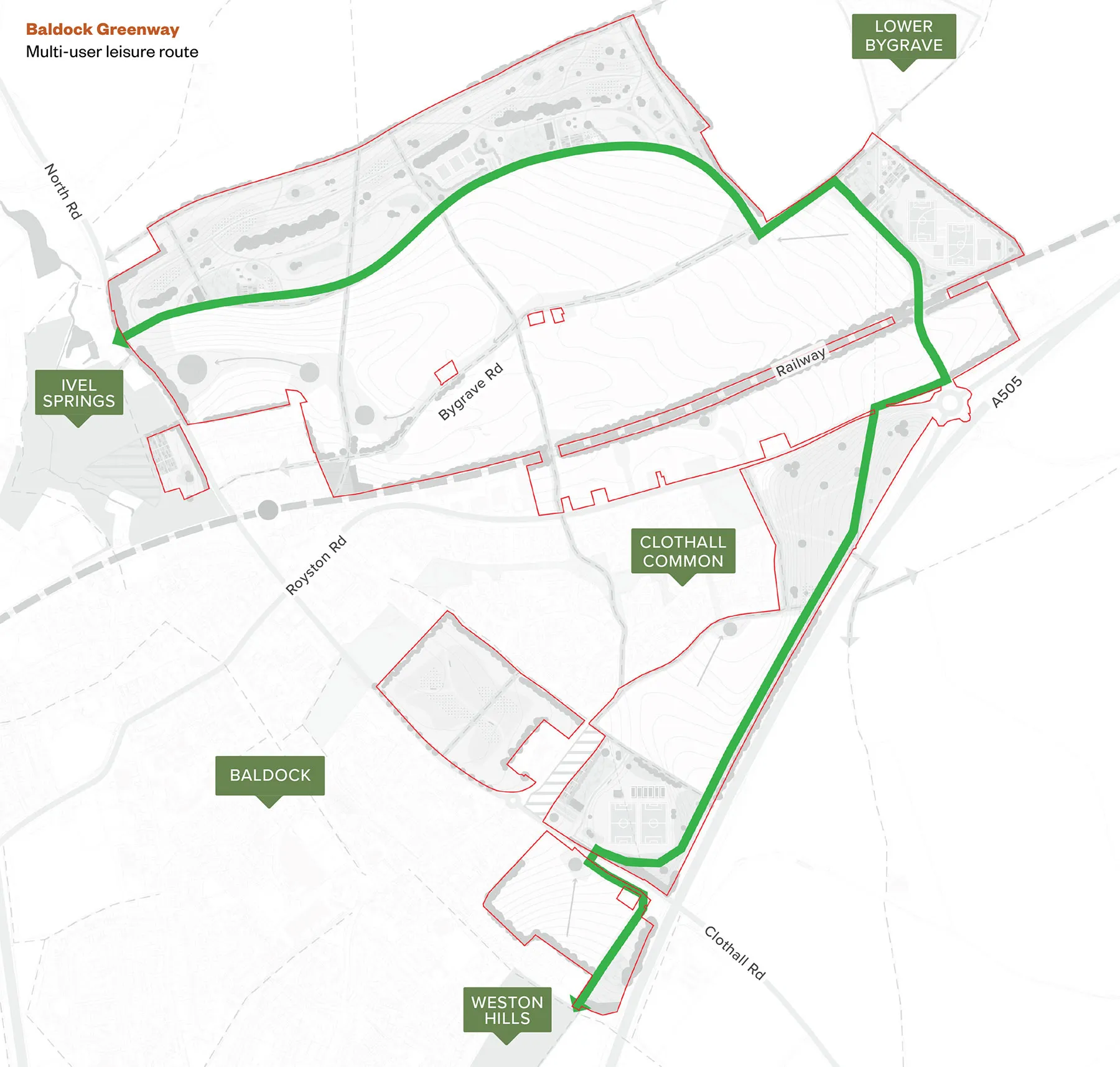
Baldock Greenway

Enhancing existing assets

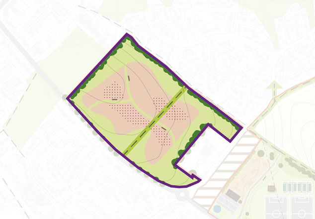
Walls Field will be transformed into a species-rich meadow grassland, with mown paths, hedgerow and tree planting around the edges, and information about the Scheduled Monument located there.
Image
Natural/semi natural open space: wildflower meadows

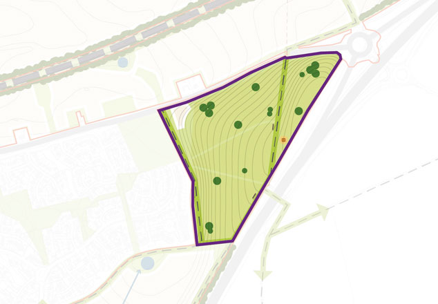
We want feedback on how we evolve (and name!) the green space east of Clothall Common. We see opportunities to include informal footpaths, seating areas, information boards, managed grassland and scrub habitats.

Image

Natural/semi natural open space: chalk scrublands

    Creating new parks and green spaces

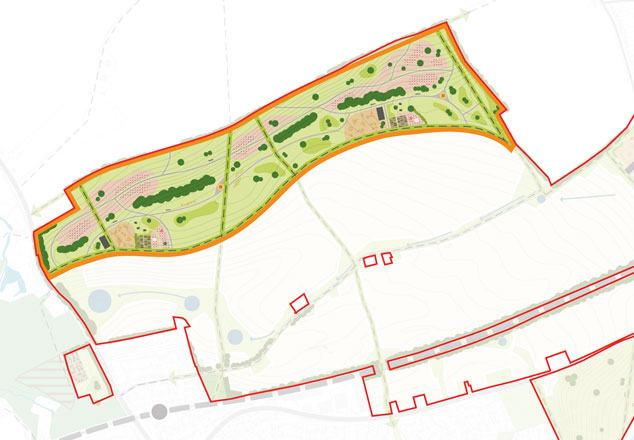
    Bygrave Common: A new 40-hectare public park offering natural habitats, play areas and orchards. Millers Way will be preserved as a grass track, with new walking, cycling and equestrian routes through the Common. The northern section will form new natural space designed to support nature, with habitat enhancements targeting species such as Corn Bunting and other species identified within the Nature Recovery Network.
    Image

    Natural/semi natural open space: chalk scrublands

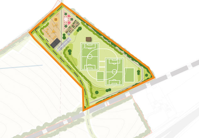
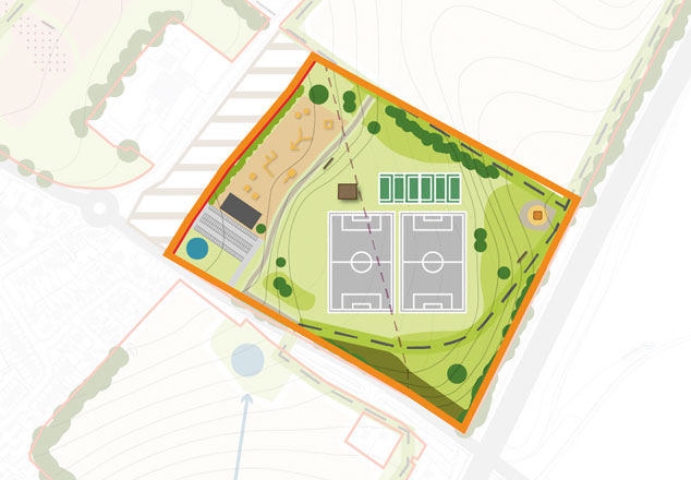
    Heritage Park: Archaeological insights will help shape the design of this local park, which will include sports pitches, play areas and community gardens. Planting within the park and on the edges will assist in softening views of the expanded town from Lower Bygrave.
    Heritage Park

    Local park

    Urban open land/‘Cambrai Field’: This area will enhance the existing Clothall Road allotments and provide inclusive spaces for all generations — featuring sports facilities, play areas and open green space.
    Urban open land

    Local park

      In the Outline Application, detailed information about these plans will be provided in the following documents:
      Key document What it will show
      Parameter Plan Areas of retained and new habitat
      Green Infrastructure Strategy Locations and types of green space
      Biodiversity Net Gain Plan Areas of biodiversity net gain
      Ecological Management Plan How ecological areas will be managed
      Environmental Statement (ecology) Ecological impacts and mitigation
      Environmental Statement (Landscapeand Visual Impact Assessment) Effects of development on landscape and views
      next page
      Transport