Transport
Most places in Baldock are within a 15-minute walk or bike ride. However, we know that many people don’t feel safe walking or cycling on certain roads. As a result, they rely on their cars more than they’d prefer. We want to use Baldock’s growth as an opportunity to help people travel safely and sustainably.
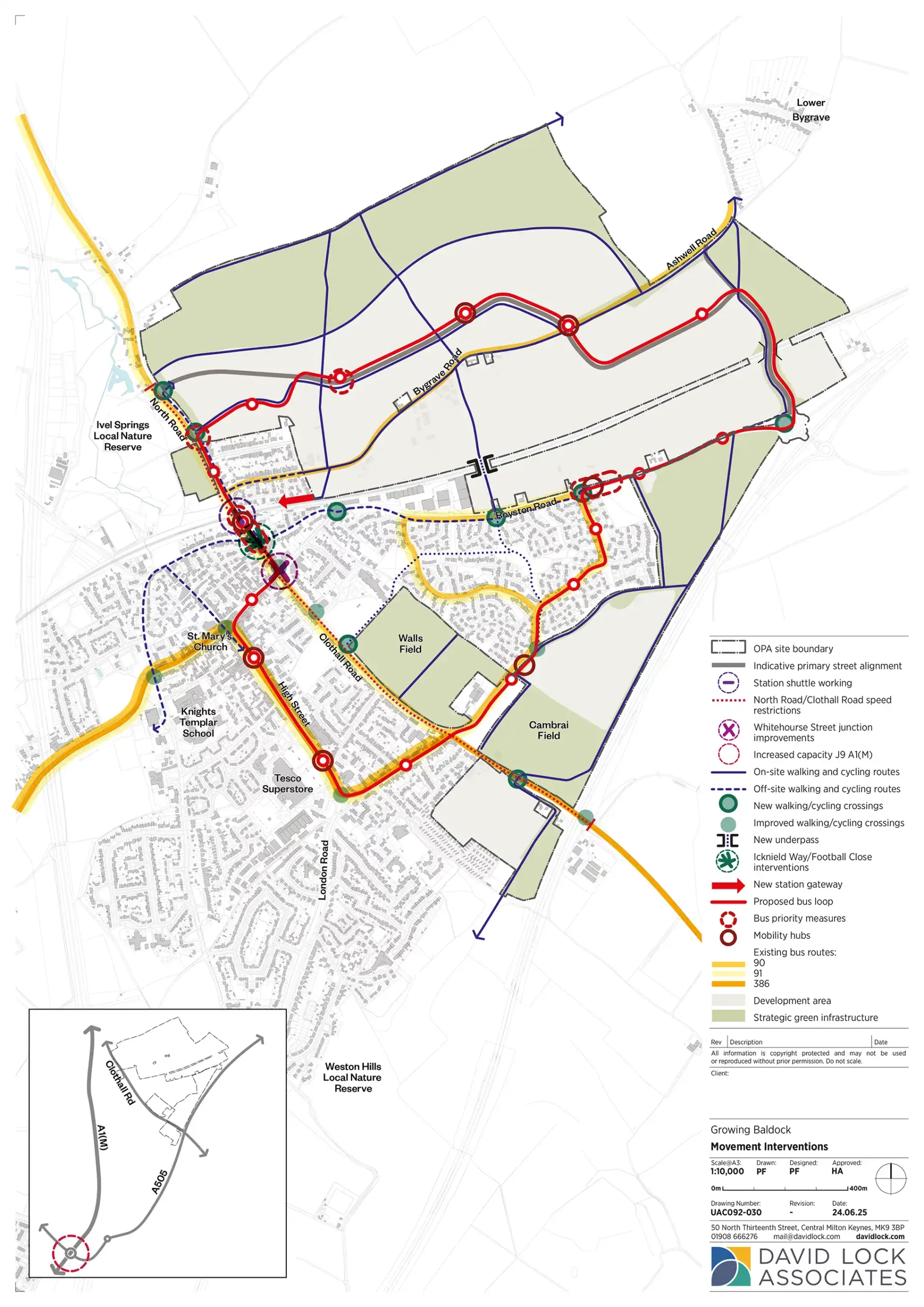
Our 3-Point Plan
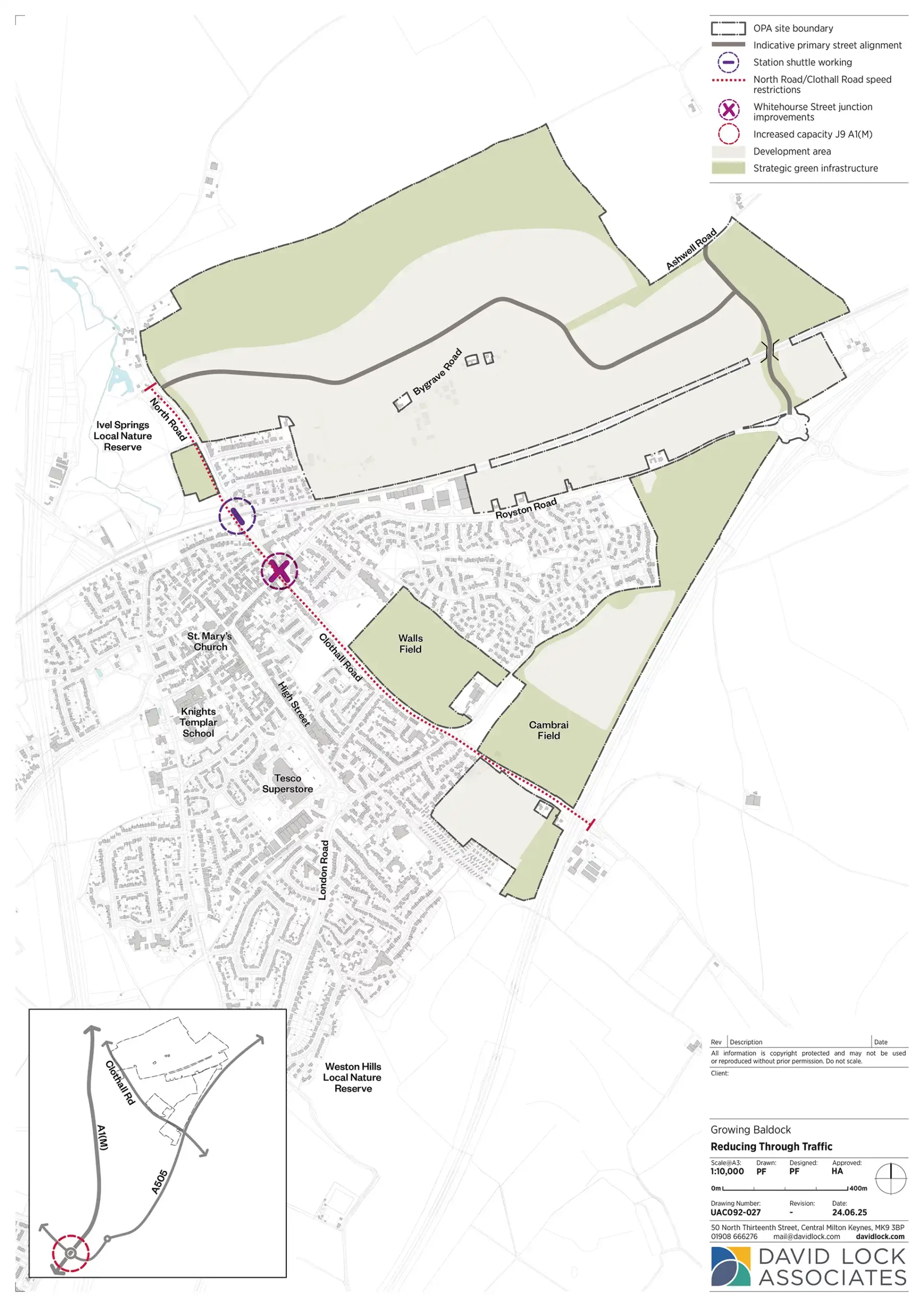
Reducing through traffic

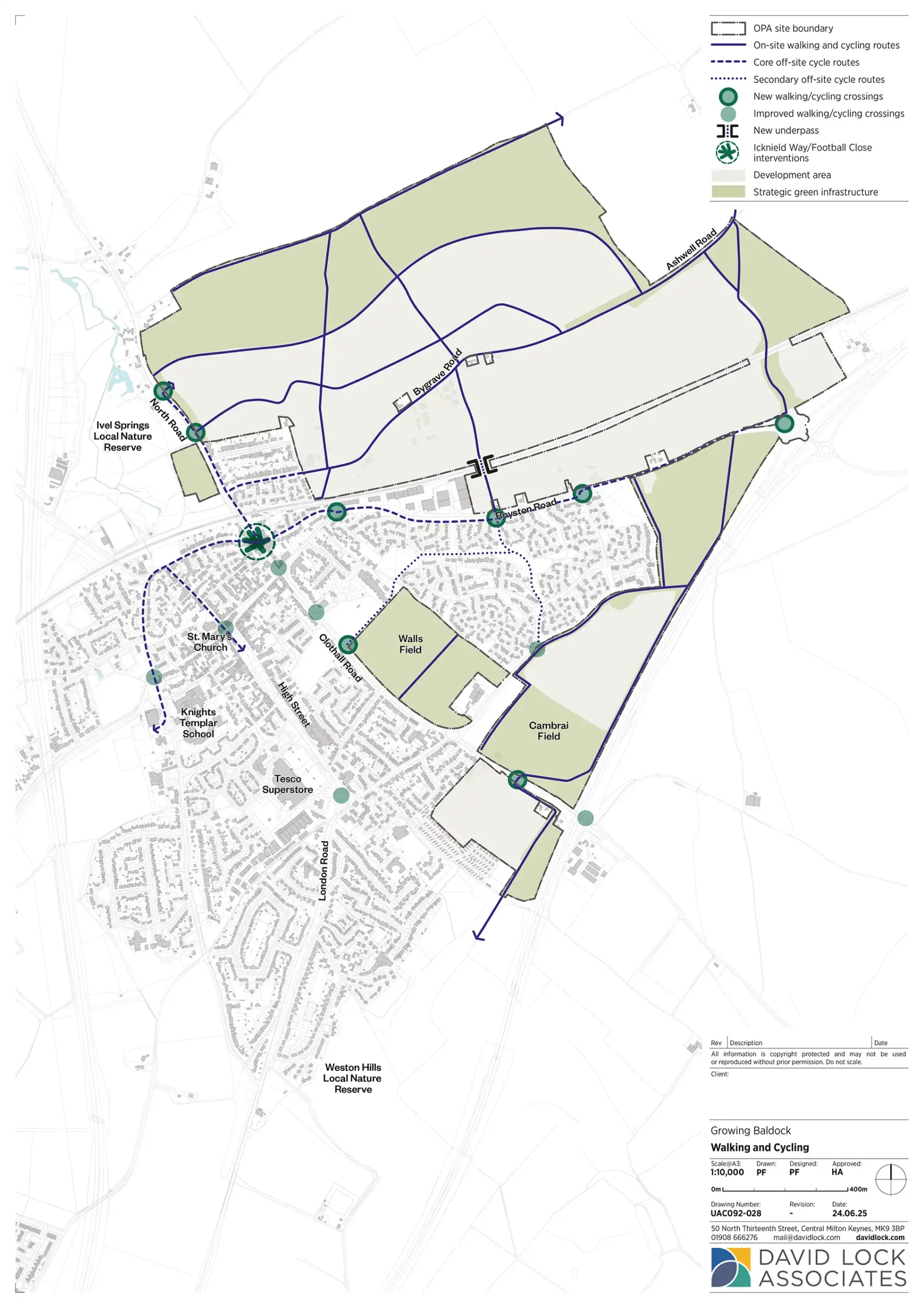
Safer walking and cycling

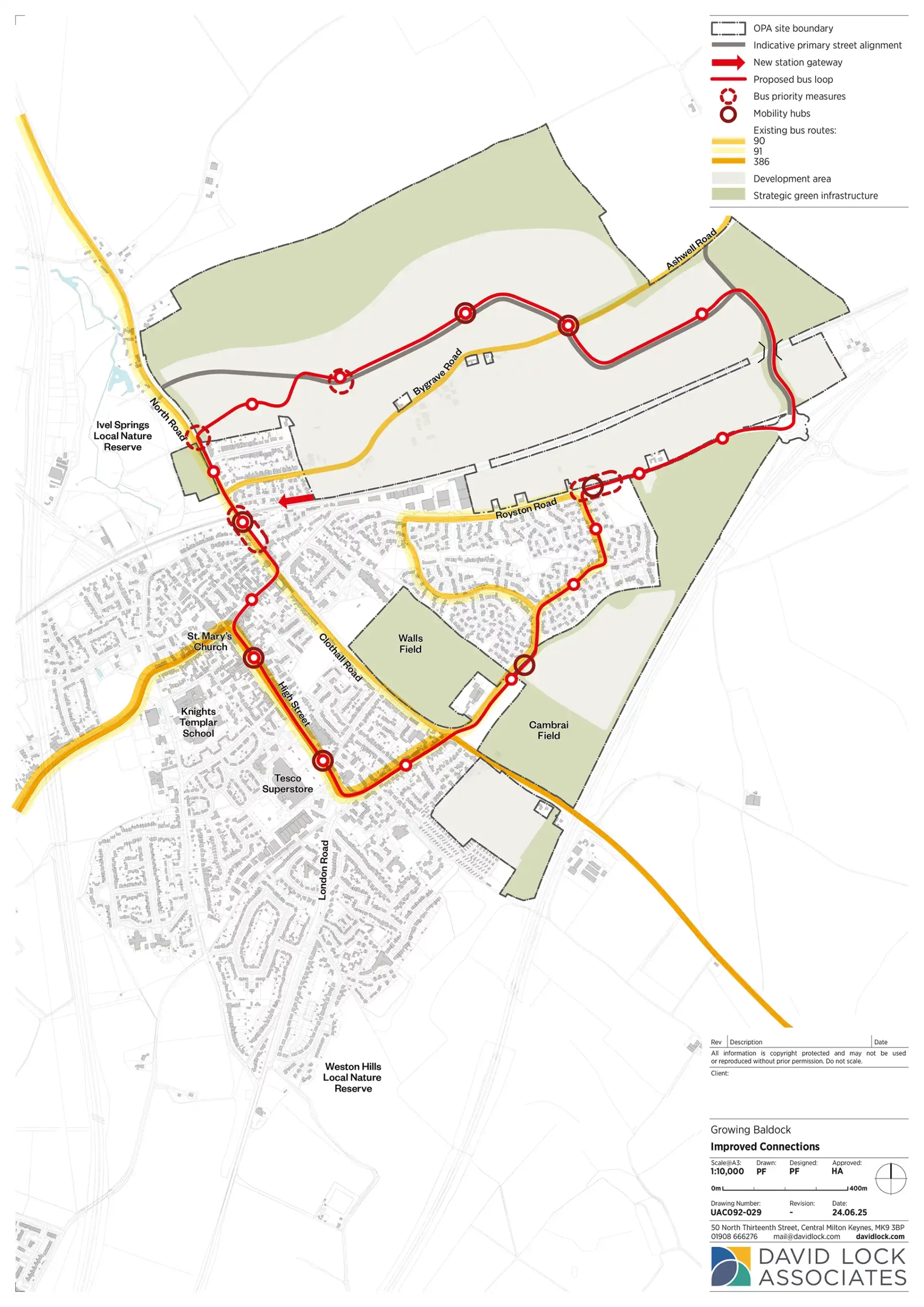
Improving connections

1 Reduce through-traffic that doesn’t benefit Baldock — especially lorries — to ease congestion, improve air quality and make roads safer.
2 Create a Create a ‘Walk and Cycle First’ town — making it safer and quicker to walk or cycle to key locations. We are aiming for half of all trips by new residents to be made on foot, by bike, or via public transport.
3 Improve connections between Baldock and nearby villages through new road, cycle and bus links.
We will achieve this by:
- Building a new road across the railway line to link north Baldock with Royston Road and the A505.
- Introducing a one-way alternating traffic system under the Station Road railway bridge.
- Supporting lower speed limits on North Road, Station Road and Clothall Road.
- Investigating further restrictions on lorries unnecessarily using town roads.
We will deliver this through:
- New pedestrian and cycle crossings over and under the railway.
- Best-practice design of new homes to connect directly with walking and cycling routes.
- Safe, direct walking and cycling routes to schools, shops and services, both for new homes and across the wider town.
- Maps and signage to promote awareness of new connections.
- Reducing car and lorry dominance in the town centre.
We will support this with:
- A new road link to provide better access to the town centre, retaining Bygrave Road as a pleasant walking and cycling route.
- Improved access to the station via a new northern entrance with walking, cycling and bus connections.
- Integrated bus services, including coordination with existing routes and a new shuttle loop through the town.
- Exploring ‘mini-hubs’ around town for bike storage and rental.
This summary highlights key proposals from a comprehensive transport strategy, built on three years of consultation and analysis, and includes a wide range of integrated initiatives. These plans will be tested through Hertfordshire County Council’s Transport Modelling process.
As homes are delivered, travel behaviour will be monitored and interventions will be adjusted and phased accordingly.
Bringing it all together

Helping you get around PDF
We know that there have been a lot of questions on some of the detailed interventions proposed. This downloadable booklet 'Helping you get around' provides explanations and diagrams of the current thinking at specific locations.
| Key document | What it will show |
|---|---|
| Parameter Plan | Key access points and routes through the site |
| Transport Statement | Approach to transport on site and wider impacts and mitigation |
| Environmental Statement (transport) | Transport impacts and mitigation |
| Travel Assessment | Measures to encourage active and sustainable modes of transport |
| Design and Access Statement | Street and walking/cycling route types and car parking principles |